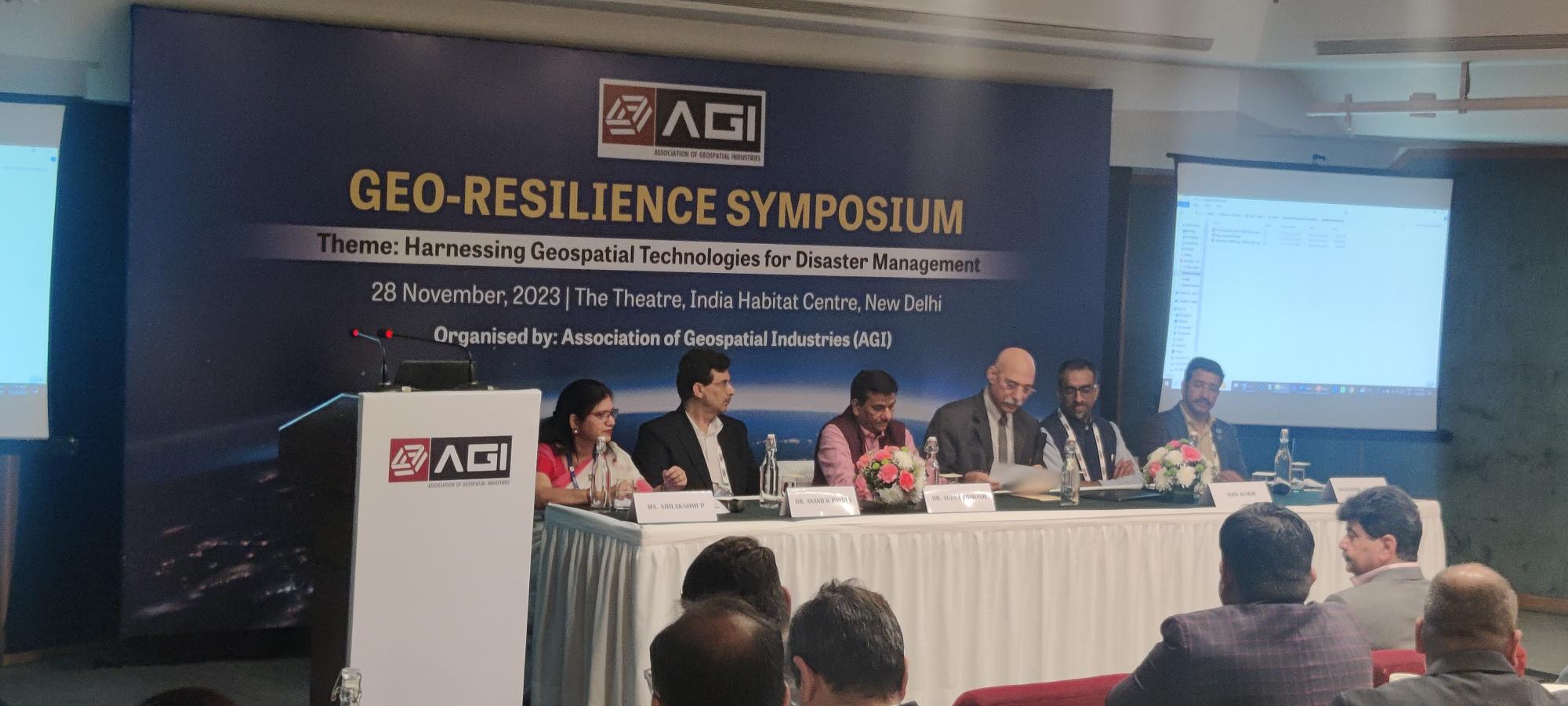
In today’s world, where natural disasters are becoming increasingly frequent and severe, the need for effective disaster management strategies is more crucial than ever. Geospatial technologies, such as Geographic Information Systems (GIS) and remote sensing, have emerged as powerful tools for disaster preparedness, response, and recovery.
At the AGI GeoResilience Symposium, Dr. Mrutunjay Mohapatra, Director General of Meteorology at IMD, emphasized the critical role of high-resolution geospatial data in disaster management. He stated, “We have the framework but need better data.”
High-resolution data can provide a detailed and accurate understanding of the terrain, infrastructure, and population density in disaster-prone areas. This information is essential for developing effective disaster preparedness plans and for guiding emergency response efforts.
Digital Elevation Modelling (DEM) is a geospatial technique that creates a three-dimensional representation of the Earth’s surface. DEMs are particularly useful for disaster management because they can be used to identify areas that are at risk of flooding, landslides, and other natural hazards. DEMs can also be used to plan evacuation routes and to assess the damage caused by disasters.
Dr. Mohapatra highlighted the importance of using geospatial technologies to minimize real-time disasters and enhance resistance. He said, “Marine heat waves and cryosphere changes as examples of real-time disasters that can be effectively monitored and mitigated using geospatial data.”
In the first panel, Dr. Anand Kumar Pandey, Senior Principal Scientist, NGRI talked about the Joshimath tragedy, a land subsidence event that occurred in Uttarakhand, India, in 2021. The tragedy highlighted the need for better understanding and monitoring of land subsidence phenomena.
Land subsidence is a gradual lowering of the Earth’s surface due to natural or man-made causes. It can have devastating consequences, leading to the collapse of buildings, infrastructure, and even entire towns. Geospatial technologies can be used to identify areas that are at risk of land subsidence and to monitor the movement of the land over time.
Dr. Pandey emphasized the importance of subsurface characterizations in disaster management. He said, “Subsurface characterizations provide information about the composition and structure of the Earth’s surface beneath the ground. This information is essential for understanding the causes of land subsidence and for developing mitigation strategies.”
Ms. Srilakshmi P, Head NRSC-ISRO discussed the National Database for Emergency Management (NDEM), a repository of geospatial data that can be used for disaster management purposes. The NDEM includes data on hazards, infrastructure, and population density. A comprehensive geospatial data repository is essential for effective disaster management.
The repository should include data on hazards, infrastructure, population density, and other relevant factors. This data can be used to develop hazard maps, assess vulnerabilities, and plan for emergency response.
She talked about Hazard atlases are maps that show the locations and potential impacts of different types of hazards, such as floods, earthquakes, and wildfires. She said, “Hazard atlases can be used to raise awareness of hazards and to inform disaster preparedness planning and Early Warning Systems which use geospatial technologies to detect and predict hazards can provide critical lead time for evacuation and other protective measures.”
Geospatial technologies can also be used to support recovery planning. For example, they can be used to:
Geospatial technologies are powerful tools that can be used to improve disaster management at all stages of the disaster lifecycle, from preparedness to response to recovery. By harnessing the power of geospatial data and tools, one can minimize the impact of natural disasters and enhance the ability to prepare for, respond to, and recover from these events. As we continue to face the increasing threat of natural disasters, the importance of geospatial technologies will only grow. By investing in these technologies and developing a data-driven approach to disaster management, we can create a more resilient and prepared society.
Log in to leave a comment
© Geospatial Media and Communications. All Rights Reserved.

